
Route map
Start / endStopsHalfway
The Grand Canyon to Zion: the drive
The drive from Grand Canyon National Park (South Rim) to Zion National Park covers 253 miles (407 km) and takes about 4 hr 45 min without stops, mostly on US-89, AZ-64 and SR-9.
It's doable in one day, but with fuel, food and a couple of stops plan on roughly 6 hr 15 min door to door.
We found 10 worthwhile stops within about 25 miles of the route, including Cameron Trading Post, Navajo Bridge, Marble Canyon, Horseshoe Bend and Antelope Canyon.
| Main roads | Approx. miles |
|---|---|
| US-89 | 173 |
| AZ-64 | 54 |
| SR-9 | 24 |
Best time to go: April to June and September to November. Summer is hot and crowded; winter is quiet.
Best stops between the Grand Canyon and Zion
Before you leave the Grand Canyon
- 1
Desert View Watchtower
Mary Colter's 1932 stone tower at the east end of the South Rim, and the first viewpoint if you enter from Cameron.

Photo: Grand Canyon National Park · Public domain
- 2
Cameron Trading Post
A historic trading post above the Little Colorado River, known for Navajo tacos and a large Native arts gallery.
- 3
Navajo Bridge, Marble Canyon
Walk the historic 1929 bridge 470 feet above the Colorado River and look for California condors roosting underneath.
- 4
Horseshoe Bend
The famous 1,000-foot overlook of a Colorado River meander, reached by an easy 1.5-mile round-trip walk. Paid parking.

Photo: Thomas Wolf, www.foto-tw.de · CC BY-SA 3.0 - 5
Antelope Canyon
Sculpted slot canyons on Navajo land, visited only with a licensed tour. Upper is for light beams, Lower for ladders and curves.

Photo: Lucas Löffler · Public domain - 6
Glen Canyon Dam & Lake Powell
The Carl Hayden Visitor Center overlooks the dam and the start of Lake Powell's 1,900 miles of shoreline.

Photo: Adbar · CC BY-SA 3.0 - 7
Kodachrome Basin State Park
Tall sandstone chimneys named by National Geographic after the color film, 20 minutes from Bryce.
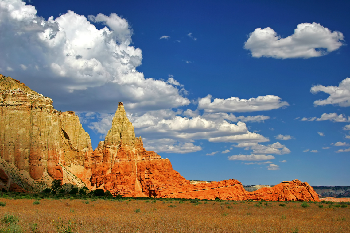
Photo: Photographersnature · CC BY-SA 3.0
Near Zion
- 8
Kanab
'Little Hollywood': a central base between Zion, Bryce, the Grand Canyon North Rim and Page, and the permit office for The Wave.

Photo: P199 · CC BY-SA 3.0 - 9
Coral Pink Sand Dunes State Park
Shifting pink sand dunes between Zion and Kanab, where you can rent sandboards.

Photo: Staplegunther (David Jolley) · CC BY-SA 3.0 - 10
Kolob Canyons (Zion)
Zion's quiet northwest corner, with a 5-mile scenic drive right off I-15 at exit 40 and no shuttle needed.
Where to stay in Springdale
Utah's most visited park: The Narrows, Angels Landing and a canyon floor you reach by shuttle from Springdale. Springdale is the closest town with lodging. Rooms near national parks sell out in peak season, so book early.
Map not loading? See places to stay near Springdale →
Trip cost calculator
Estimate gas or charging, hotels and car rental for a round trip from the Grand Canyon to Zion:
The Grand Canyon to Zion road trip FAQ
How long is the drive from Grand Canyon National Park (South Rim) to Zion National Park?
About 4 hr 45 min without stops for 253 miles via US-89, AZ-64 and SR-9. With breaks for fuel and food, allow around 6 hr 15 min.
What is the halfway point between the Grand Canyon and Zion?
Page, AZ is about halfway, roughly 127 miles from each end. It's a good place for fuel and a meal.
Can you drive from the Grand Canyon to Zion in one day?
Yes. At 4 hr 45 min of driving it's a comfortable one-day trip. Leave early so you arrive with daylight to spare.
What are the best stops between the Grand Canyon and Zion?
Top stops include Cameron Trading Post, Navajo Bridge, Marble Canyon, Horseshoe Bend and Antelope Canyon. See the full list with detour times above.
How much does gas cost from the Grand Canyon to Zion?
About $33 one way in a car that gets 28 mpg with gas at $3.60 a gallon. Use the calculator on this page to plug in your own car and prices.
When is the best time to visit Zion?
April to June and September to November. Summer is hot and crowded; winter is quiet.
Route calculated from OpenStreetMap data and checked 2026-11-09. Drive times assume normal traffic and no stops.
