State guide

California road trips

17 routes that start or end in California, and 21 stops worth pulling over for.

Popular starting points: road trips from LA · road trips from San Diego · road trips from San Francisco

Routes

Palm Springs
Photo: Visitor7 · CC BY-SA 3.0
LA to Palm Springs
107 mi · 1 hr 45 min
Under two hours without traffic, swapping the city for mid-century pools and the Aerial Tramway.
Death Valley National Park
Photo: Brocken Inaglory · CC BY-SA 3.0
Las Vegas to Death Valley
123 mi · 2 hr 15 min
Two hours to the lowest point in North America. Go in winter, fill the tank in Pahrump, and loop back via Beatty and the Rhyolite ghost town.
Joshua Tree National Park
Photo: Jarek Tuszyński · CC BY-SA 3.0
LA to Joshua Tree
128 mi · 2 hr 15 min
A quick desert getaway past the Cabazon Dinosaurs. Stay in Joshua Tree or Twentynine Palms for the stars.
Joshua Tree National Park
Photo: Jarek Tuszyński · CC BY-SA 3.0
San Diego to Joshua Tree
144 mi · 2 hr 30 min
Up through the Inland Empire or the back way through Julian and Anza-Borrego for wildflowers in spring.
Yosemite National Park
Photo: Thomas Wolf, www.foto-tw.de · CC BY-SA 3.0
San Francisco to Yosemite
188 mi · 4 hrs
Four hours through the Central Valley and Sierra foothills. Leave before dawn to reach Tunnel View early.
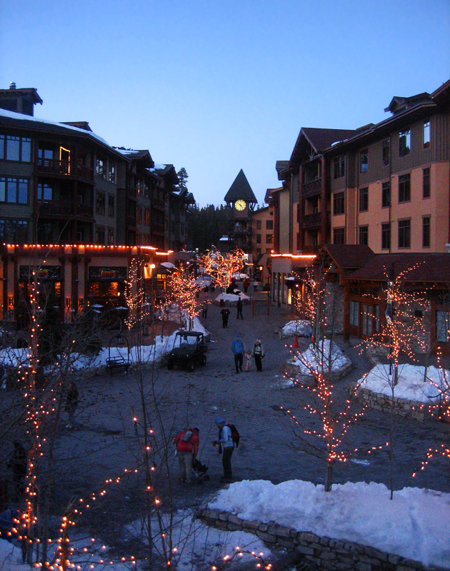
Lake Tahoe (South Lake Tahoe)
Photo: Lara Farhadi · CC BY 2.0
San Francisco to Lake Tahoe
188 mi · 3 hr 15 min
Three and a half hours on US-50 or I-80. Old Sacramento makes a good break, and in winter you'll need chains.
Las Vegas
Photo: Mariordo (Mario Roberto Durán Ortiz) · CC BY-SA 4.0
LA to Las Vegas
270 mi · 4 hr 15 min
America's most-driven road trip. The trick is when you leave: Friday afternoons and Sunday returns can double the drive time.
Yosemite National Park
Photo: Thomas Wolf, www.foto-tw.de · CC BY-SA 3.0
LA to Yosemite
310 mi · 5 hr 30 min
Up I-5 or CA-99 through the Central Valley, then CA-41 via Fresno to the south entrance. Mariposa Grove is your first stop.
San Diego
Photo: Dirk Hansen · CC BY-SA 3.0
Las Vegas to San Diego
331 mi · 5 hr 15 min
The I-15 corridor from Vegas to the coast. Plan stops in Yermo or Barstow, and start early to beat Inland Empire traffic.
Phoenix
Photo: DPPed · CC BY-SA 3.0
San Diego to Phoenix
354 mi · 5 hr 30 min
I-8 east hugs the Mexican border past the Imperial Sand Dunes and Yuma's old territorial prison.
Phoenix
Photo: DPPed · CC BY-SA 3.0
LA to Phoenix
373 mi · 5 hr 45 min
Five-plus hours of I-10 through the Coachella Valley and the open Sonoran Desert. Fuel up at Blythe before Arizona's emptiest stretch.
San Francisco
Photo: Frank Schulenburg · CC BY-SA 4.0
LA to San Francisco
382 mi · 6 hrs
I-5 is the fastest way north, about six hours with stops. This page covers that inland route.
Yosemite National Park
Photo: Thomas Wolf, www.foto-tw.de · CC BY-SA 3.0
Las Vegas to Yosemite
406 mi · 7 hr 45 min · 2 days
In summer the best route crosses Tioga Pass past Mono Lake and Bodie. In winter Tioga is closed and the drive is much longer.
Zion National Park
Photo: Diliff · CC BY-SA 3.0
LA to Zion
428 mi · 6 hr 45 min · 2 days
Fly-free access to Utah: through Vegas on I-15, with an overnight in St. George or Springdale.
Sedona
Photo: Terrydarc · CC BY-SA 3.0
LA to Sedona
478 mi · 7 hr 30 min · 2 days
A long desert day on I-10 or I-40. Break it up in Palm Springs or at the Route 66 towns.
Grand Canyon National Park (South Rim)
Photo: Murray Foubister · CC BY-SA 2.0
LA to the Grand Canyon
491 mi · 7 hr 30 min · 2 days
I-40 across the Mojave, then Route 66 towns like Seligman and Williams before the South Rim. Most people split this into two days.
Grand Canyon National Park (South Rim)
Photo: Murray Foubister · CC BY-SA 2.0
San Diego to the Grand Canyon
532 mi · 8 hr 30 min · 2 days
A long but simple drive inland through the desert. Split it at Flagstaff or Williams for a sunrise at the rim.

Stops worth the detour in California

Calico Ghost Town
Photo: Alexander Mason · CC BY 4.0

Calico Ghost Town

1–2 hrs

A restored 1880s silver mining town above Barstow, with a mine tour, small museum and old-west storefronts.

Peggy Sue's 50's Diner

45 min

A kitschy 1950s diner in Yermo, right off I-15, and the classic meal stop on the LA–Vegas drive.

Kelso Depot (Mojave National Preserve)
Photo: w:User:Pretzelpaws · CC BY-SA 3.0

Kelso Depot (Mojave National Preserve)

1–2 hrs

A 1924 Spanish Mission–style railroad depot turned visitor center, near the 600-foot Kelso Dunes. A quieter alternative to the I-15 grind.

Cabazon Dinosaurs
Photo: CityMorgue · CC BY-SA 4.0

Cabazon Dinosaurs

30–60 min

Giant roadside dinosaurs off I-10 near Palm Springs, built in the 1960s and made famous by Pee-wee's Big Adventure.

General Patton Memorial Museum

45 min

A WWII desert training center museum at Chiriaco Summit on I-10, with tanks parked outside. A good leg-stretch on the long desert run.

Anza-Borrego Desert State Park
Photo: No machine-readable author provided. Miskatonic assumed (based on copyright clai · CC BY 2.5

Anza-Borrego Desert State Park

2–4 hrs

California's largest state park, famous for spring wildflower blooms and the 130 metal sculptures scattered around Borrego Springs.

Julian
Photo: --Microsomen 17:11, 31 May 2005 (UTC) · CC BY 2.0

Julian

1 hr

A mountain gold-rush town known for its apple pie. It sits on the scenic back route between San Diego and the desert.

Alabama Hills
Photo: steveberardi · CC BY-SA 2.0

Alabama Hills

1–2 hrs

Rounded boulders and natural arches below Mount Whitney near Lone Pine, the backdrop for hundreds of Western films.

Manzanar National Historic Site

1–2 hrs

A sobering, well-done museum and driving tour at one of the camps where Japanese Americans were incarcerated during WWII.

Mono Lake South Tufa
Photo: Dicklyon · CC BY 4.0

Mono Lake South Tufa

1 hr

Otherworldly limestone towers rising from an ancient salt lake just east of Yosemite's Tioga Pass.

Bodie State Historic Park
Photo: Roland Arhelger · CC BY-SA 4.0

Bodie State Historic Park

2 hrs

California's best-preserved ghost town, left in a state of arrested decay. The last 3 miles are dirt and the road is snowbound in winter.

Mammoth Lakes
Photo: Perfect Zero from Los Angeles, CA, US · CC BY 2.0

Mammoth Lakes

2+ hrs

An Eastern Sierra resort town with Devils Postpile, hot springs and summer gondola rides up Mammoth Mountain.

Emerald Bay State Park
Photo: Eric Philbin · CC0

Emerald Bay State Park

1–2 hrs

The most photographed spot at Lake Tahoe, with Vikingsholm castle a steep one-mile walk below the overlook.

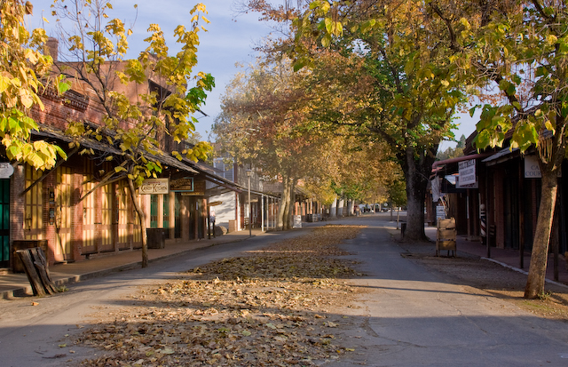
Old Sacramento
Photo: Morn (talk) · CC BY-SA 3.0

Old Sacramento

1–2 hrs

Gold-rush-era riverfront streets with the excellent California State Railroad Museum.

Fort Tejon State Historic Park
Photo: Yellowute at English Wikipedia · Public domain

Fort Tejon State Historic Park

45 min

An 1850s US Army dragoon post in a shady oak grove right beside I-5 on the Grapevine. A calm break before or after the climb over the Tejon Pass.

Harris Ranch

1 hr

The best-known halfway stop on I-5 between LA and San Francisco: a restaurant, bakery and fuel at the Coalinga exit.

Forestiere Underground Gardens
Photo: Carol M. Highsmith · Public domain

Forestiere Underground Gardens

1 hr

A Sicilian immigrant hand-dug this cool network of tunnels, courtyards and fruit trees under Fresno over 40 years. Tours run seasonally.

Mariposa Grove of Giant Sequoias

2 hrs

Yosemite's largest sequoia grove, home of the Grizzly Giant, just inside the south entrance. A free shuttle runs from the welcome plaza in season.

Groveland
Photo: Almonroth · CC BY-SA 3.0

Groveland

45 min

A gold-rush town on CA-120 with the 1850s Iron Door Saloon, and the last easy food and fuel before Yosemite's Big Oak Flat entrance.

Columbia State Historic Park
Photo: Chris Krylov · CC BY 3.0

Columbia State Historic Park

1–2 hrs

A car-free gold-rush town with stagecoach rides, gold panning and an 1850s saloon, near Sonora.

Placerville & Apple Hill
Photo: Quintin Soloviev · CC BY 4.0

Placerville & Apple Hill

1–2 hrs

Old 'Hangtown' on US-50, with the Apple Hill farm and cider-mill loop just above it. Busiest in autumn.