Road trip guides
All road trips
Every route, grouped by the state you start in and sorted from shortest to longest.
Starting in Arizona

Phoenix to Tucson
113 mi · 1 hr 45 min
Under two hours on I-10. Climb Picacho Peak on the way or detour to Biosphere 2.

Sedona to the Grand Canyon
114 mi · 2 hr 15 min
North through Oak Creek Canyon's switchbacks on SR-89A, then up from Flagstaff to the South Rim.

Phoenix to Sedona
116 mi · 2 hrs
Two hours up I-17, but the last 15 miles on SR-179 through the Red Rock Scenic Byway is the reason you came.

Page to Monument Valley
126 mi · 2 hr 15 min
Two hours across Navajo land to the most iconic buttes in the West. Time it for sunset at the Tribal Park.
Flagstaff to Page
134 mi · 2 hr 30 min
A two-hour run on US-89 across the Painted Desert, ending at Horseshoe Bend for sunset.
The Grand Canyon to Page
139 mi · 2 hr 30 min
Leave via Desert View Drive for the east-rim viewpoints, then follow the Little Colorado to Page.
Phoenix to the Grand Canyon
228 mi · 3 hr 30 min
The classic Arizona drive: cactus to pine forest in 3.5 hours, with Montezuma Castle on the way and an optional detour through Sedona.

The Grand Canyon to Zion
253 mi · 4 hr 45 min
A core leg of the Grand Circle loop via Page, Kanab and the Zion–Mount Carmel tunnel.
Phoenix to Page
278 mi · 4 hr 30 min
Through Flagstaff and across the Navajo Nation on US-89, past the Cameron Trading Post and the Vermilion Cliffs.
Tucson to White Sands
327 mi · 5 hrs
Across the Chihuahuan Desert on I-10 to Las Cruces and Old Mesilla, then over San Augustin Pass.
Phoenix to Zion
392 mi · 6 hr 45 min
A big day through Flagstaff, Page and Kanab. Horseshoe Bend makes a perfect midpoint stop.

Phoenix to Albuquerque
419 mi · 6 hr 45 min
Up to Flagstaff, then east on I-40 past Meteor Crater and through the Petrified Forest.

Phoenix to Moab
467 mi · 7 hr 45 min · 2 days
Across the Navajo Nation via Monument Valley country. One of the most scenic long drives in the Southwest.
Starting in California

LA to Palm Springs
107 mi · 1 hr 45 min
Under two hours without traffic, swapping the city for mid-century pools and the Aerial Tramway.

LA to Joshua Tree
128 mi · 2 hr 15 min
A quick desert getaway past the Cabazon Dinosaurs. Stay in Joshua Tree or Twentynine Palms for the stars.
San Diego to Joshua Tree
144 mi · 2 hr 30 min
Up through the Inland Empire or the back way through Julian and Anza-Borrego for wildflowers in spring.

San Francisco to Yosemite
188 mi · 4 hrs
Four hours through the Central Valley and Sierra foothills. Leave before dawn to reach Tunnel View early.

San Francisco to Lake Tahoe
188 mi · 3 hr 15 min
Three and a half hours on US-50 or I-80. Old Sacramento makes a good break, and in winter you'll need chains.

LA to Las Vegas
270 mi · 4 hr 15 min
America's most-driven road trip. The trick is when you leave: Friday afternoons and Sunday returns can double the drive time.
LA to Yosemite
310 mi · 5 hr 30 min
Up I-5 or CA-99 through the Central Valley, then CA-41 via Fresno to the south entrance. Mariposa Grove is your first stop.

San Diego to Phoenix
354 mi · 5 hr 30 min
I-8 east hugs the Mexican border past the Imperial Sand Dunes and Yuma's old territorial prison.
LA to Phoenix
373 mi · 5 hr 45 min
Five-plus hours of I-10 through the Coachella Valley and the open Sonoran Desert. Fuel up at Blythe before Arizona's emptiest stretch.

LA to San Francisco
382 mi · 6 hrs
I-5 is the fastest way north, about six hours with stops. This page covers that inland route.
LA to Zion
428 mi · 6 hr 45 min · 2 days
Fly-free access to Utah: through Vegas on I-15, with an overnight in St. George or Springdale.
LA to Sedona
478 mi · 7 hr 30 min · 2 days
A long desert day on I-10 or I-40. Break it up in Palm Springs or at the Route 66 towns.
LA to the Grand Canyon
491 mi · 7 hr 30 min · 2 days
I-40 across the Mojave, then Route 66 towns like Seligman and Williams before the South Rim. Most people split this into two days.
San Diego to the Grand Canyon
532 mi · 8 hr 30 min · 2 days
A long but simple drive inland through the desert. Split it at Flagstaff or Williams for a sunrise at the rim.
Starting in Colorado

Durango to Mesa Verde
36 mi · 45 min
Forty-five minutes west on US-160 to Ancestral Puebloan cliff dwellings. Book Cliff Palace tour tickets ahead.

Denver to Rocky Mountain National Park
65 mi · 1 hr 15 min
Ninety minutes via Boulder and Lyons to Estes Park. Get a timed-entry permit and go early for elk and Trail Ridge Road.

Denver to Colorado Springs
69 mi · 1 hr 15 min
An hour south on I-25 to Garden of the Gods and the Pikes Peak Highway.
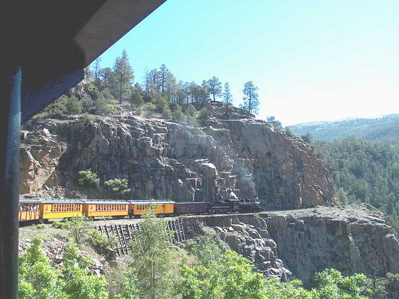
Denver to Durango
334 mi · 6 hr 15 min
A Rocky Mountain crossing via Great Sand Dunes and Wolf Creek Pass, or the longer San Juan Skyway via Ouray and Silverton.
Denver to Moab
354 mi · 5 hr 30 min
I-70 through Glenwood Canyon and past Colorado National Monument, then south from Cisco along the Colorado River on UT-128.

Denver to Santa Fe
390 mi · 5 hr 45 min
I-25 down the Front Range, over Raton Pass into New Mexico, with Capulin Volcano or Taos as detours.
Starting in Nevada

Las Vegas to Death Valley
123 mi · 2 hr 15 min
Two hours to the lowest point in North America. Go in winter, fill the tank in Pahrump, and loop back via Beatty and the Rhyolite ghost town.
Las Vegas to Zion
160 mi · 2 hr 45 min
The easiest national park escape from the Strip: under three hours up I-15 through the Virgin River Gorge, with a stop for a mini-Zion at Snow Canyon or Kolob if you have time.

Las Vegas to Bryce Canyon
260 mi · 4 hrs
A climb from desert to 8,000-foot forests. It's easy to fold Zion in on the way, either through the tunnel on UT-9 or by staying on I-15.
Las Vegas to Page
272 mi · 4 hr 30 min
Horseshoe Bend and Antelope Canyon are a long day from Vegas. The drive through Kanab and the Vermilion Cliffs is half the fun.
Las Vegas to the Grand Canyon
276 mi · 4 hr 30 min
Most people pick the West Rim because it's close. The South Rim is the real national park, and the drive there runs along a long stretch of old Route 66.
Las Vegas to Sedona
276 mi · 4 hr 45 min
Cross Hoover Dam, run Route 66 for a stretch, then drop through pine forest into red rock country.
Las Vegas to Phoenix
286 mi · 5 hrs
Desert all the way on US-93 past Hoover Dam and through the Joshua tree forest near Wikieup. Watch your fuel on the empty middle stretch.

Las Vegas to San Diego
331 mi · 5 hr 15 min
The I-15 corridor from Vegas to the coast. Plan stops in Yermo or Barstow, and start early to beat Inland Empire traffic.
Las Vegas to Monument Valley
398 mi · 6 hr 45 min · 2 days
A full-day run east through Kanab and Page into the Navajo Nation, timed to reach the buttes for sunset.
Las Vegas to Yosemite
406 mi · 7 hr 45 min · 2 days
In summer the best route crosses Tioga Pass past Mono Lake and Bodie. In winter Tioga is closed and the drive is much longer.

Las Vegas to Salt Lake City
420 mi · 6 hrs
Straight up I-15, the length of Utah. Zion's Kolob Canyons and the Fremont rock art are short detours from the interstate.
Las Vegas to Moab
457 mi · 6 hr 30 min
A big desert crossing on I-15 and I-70 through the San Rafael Swell, one of the emptiest and most dramatic interstate stretches in the US.

Las Vegas to Denver
748 mi · 11 hrs · 2 days
A two-day crossing of Utah and the Rockies on I-15 and I-70. Moab, the Colorado National Monument and Glenwood Canyon make great breaks.
Starting in New Mexico
Starting in Utah
Zion to Bryce Canyon
85 mi · 1 hr 45 min
Under two hours, but it includes the Zion–Mount Carmel Tunnel, the checkerboard mesas and Red Canyon's hoodoo arches.

Bryce Canyon to Capitol Reef
124 mi · 2 hr 45 min
Scenic Byway 12, often called one of America's most beautiful roads, crosses the Hogback ridge with drop-offs on both sides.
Capitol Reef to Moab
145 mi · 2 hr 30 min
Desert plateau driving past Goblin Valley and Green River on the way to the arches.
Moab to Monument Valley
150 mi · 2 hr 45 min
South on US-191 through Bluff and Mexican Hat, with stops at Goosenecks and the Valley of the Gods.
Salt Lake City to Moab
234 mi · 4 hrs
Four hours down US-6 through Price and Green River to Arches. Book Arches timed entry before you set off.
Salt Lake City to Zion
309 mi · 4 hr 30 min
South on I-15 for four and a half hours. Detour to Cedar Breaks in summer for alpine views.
Zion to Moab
345 mi · 5 hrs
Two Mighty 5 parks connected by I-70 through the San Rafael Swell, or by Byway 12 if you want to see Bryce and Capitol Reef too.
Salt Lake City to Denver
519 mi · 7 hr 45 min · 2 days
I-80 across Wyoming is the fastest, though storms can close it in winter. The I-70 route through the Rockies is slower but far prettier.