State guide

Arizona road trips

24 routes that start or end in Arizona, and 26 stops worth pulling over for.

Popular starting points: road trips from Phoenix · road trips from the Grand Canyon

Routes

Tucson
Photo: John Diebolt · Public domain
Phoenix to Tucson
113 mi · 1 hr 45 min
Under two hours on I-10. Climb Picacho Peak on the way or detour to Biosphere 2.
Grand Canyon National Park (South Rim)
Photo: Murray Foubister · CC BY-SA 2.0
Sedona to the Grand Canyon
114 mi · 2 hr 15 min
North through Oak Creek Canyon's switchbacks on SR-89A, then up from Flagstaff to the South Rim.
Sedona
Photo: Terrydarc · CC BY-SA 3.0
Phoenix to Sedona
116 mi · 2 hrs
Two hours up I-17, but the last 15 miles on SR-179 through the Red Rock Scenic Byway is the reason you came.
Monument Valley
Photo: Domenico Convertini · CC BY-SA 2.0
Page to Monument Valley
126 mi · 2 hr 15 min
Two hours across Navajo land to the most iconic buttes in the West. Time it for sunset at the Tribal Park.
Flagstaff to Page
134 mi · 2 hr 30 min
A two-hour run on US-89 across the Painted Desert, ending at Horseshoe Bend for sunset.
The Grand Canyon to Page
139 mi · 2 hr 30 min
Leave via Desert View Drive for the east-rim viewpoints, then follow the Little Colorado to Page.
Monument Valley
Photo: Domenico Convertini · CC BY-SA 2.0
Moab to Monument Valley
150 mi · 2 hr 45 min
South on US-191 through Bluff and Mexican Hat, with stops at Goosenecks and the Valley of the Gods.
Grand Canyon National Park (South Rim)
Photo: Murray Foubister · CC BY-SA 2.0
Phoenix to the Grand Canyon
228 mi · 3 hr 30 min
The classic Arizona drive: cactus to pine forest in 3.5 hours, with Montezuma Castle on the way and an optional detour through Sedona.
Zion National Park
Photo: Diliff · CC BY-SA 3.0
The Grand Canyon to Zion
253 mi · 4 hr 45 min
A core leg of the Grand Circle loop via Page, Kanab and the Zion–Mount Carmel tunnel.
Las Vegas to Page
272 mi · 4 hr 30 min
Horseshoe Bend and Antelope Canyon are a long day from Vegas. The drive through Kanab and the Vermilion Cliffs is half the fun.
Grand Canyon National Park (South Rim)
Photo: Murray Foubister · CC BY-SA 2.0
Las Vegas to the Grand Canyon
276 mi · 4 hr 30 min
Most people pick the West Rim because it's close. The South Rim is the real national park, and the drive there runs along a long stretch of old Route 66.
Sedona
Photo: Terrydarc · CC BY-SA 3.0
Las Vegas to Sedona
276 mi · 4 hr 45 min
Cross Hoover Dam, run Route 66 for a stretch, then drop through pine forest into red rock country.
Phoenix to Page
278 mi · 4 hr 30 min
Through Flagstaff and across the Navajo Nation on US-89, past the Cameron Trading Post and the Vermilion Cliffs.
Phoenix
Photo: DPPed · CC BY-SA 3.0
Las Vegas to Phoenix
286 mi · 5 hrs
Desert all the way on US-93 past Hoover Dam and through the Joshua tree forest near Wikieup. Watch your fuel on the empty middle stretch.
Tucson to White Sands
327 mi · 5 hrs
Across the Chihuahuan Desert on I-10 to Las Cruces and Old Mesilla, then over San Augustin Pass.
Phoenix
Photo: DPPed · CC BY-SA 3.0
San Diego to Phoenix
354 mi · 5 hr 30 min
I-8 east hugs the Mexican border past the Imperial Sand Dunes and Yuma's old territorial prison.
Phoenix
Photo: DPPed · CC BY-SA 3.0
LA to Phoenix
373 mi · 5 hr 45 min
Five-plus hours of I-10 through the Coachella Valley and the open Sonoran Desert. Fuel up at Blythe before Arizona's emptiest stretch.
Zion National Park
Photo: Diliff · CC BY-SA 3.0
Phoenix to Zion
392 mi · 6 hr 45 min
A big day through Flagstaff, Page and Kanab. Horseshoe Bend makes a perfect midpoint stop.
Monument Valley
Photo: Domenico Convertini · CC BY-SA 2.0
Las Vegas to Monument Valley
398 mi · 6 hr 45 min · 2 days
A full-day run east through Kanab and Page into the Navajo Nation, timed to reach the buttes for sunset.
Albuquerque
Photo: Quintin Soloviev · CC BY 4.0
Phoenix to Albuquerque
419 mi · 6 hr 45 min
Up to Flagstaff, then east on I-40 past Meteor Crater and through the Petrified Forest.
Moab
Photo: Quintin Soloviev · CC BY 4.0
Phoenix to Moab
467 mi · 7 hr 45 min · 2 days
Across the Navajo Nation via Monument Valley country. One of the most scenic long drives in the Southwest.
Sedona
Photo: Terrydarc · CC BY-SA 3.0
LA to Sedona
478 mi · 7 hr 30 min · 2 days
A long desert day on I-10 or I-40. Break it up in Palm Springs or at the Route 66 towns.
Grand Canyon National Park (South Rim)
Photo: Murray Foubister · CC BY-SA 2.0
LA to the Grand Canyon
491 mi · 7 hr 30 min · 2 days
I-40 across the Mojave, then Route 66 towns like Seligman and Williams before the South Rim. Most people split this into two days.
Grand Canyon National Park (South Rim)
Photo: Murray Foubister · CC BY-SA 2.0
San Diego to the Grand Canyon
532 mi · 8 hr 30 min · 2 days
A long but simple drive inland through the desert. Split it at Flagstaff or Williams for a sunrise at the rim.

Stops worth the detour in Arizona

Yuma Territorial Prison
Photo: Ralph Hawkins · CC BY-SA 3.0

Yuma Territorial Prison

1 hr

An 1876 hilltop prison above the Colorado River, now a state historic park with cells you can walk through.

London Bridge, Lake Havasu City
Photo: Guninvalid · CC0

London Bridge, Lake Havasu City

1 hr

The 1830s London Bridge, shipped stone by stone to the Arizona desert in the 1960s and rebuilt over a channel of Lake Havasu.

Oatman
Photo: Pretzelpaws [1] · CC BY-SA 3.0

Oatman

1 hr

A Route 66 mining town where wild burros wander the main street. The drive over Sitgreaves Pass is narrow and twisty.

Kingman Route 66 Museum
Photo: Calvin Beale · Public domain

Kingman Route 66 Museum

1 hr

In Kingman's historic powerhouse, covering the Mother Road from wagon trails to the Dust Bowl.

Hackberry General Store
Photo: Marine 69-71 · CC BY-SA 4.0

Hackberry General Store

30 min

A classic Route 66 roadside stop crammed with old gas pumps, signs and a vintage Corvette.

Seligman
Photo: Vidor at en.wikipedia · Public domain

Seligman

45 min

The town credited with reviving Route 66, full of quirky diners and souvenir shops.

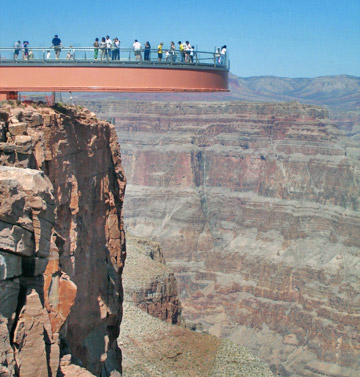
Grand Canyon West Skywalk
Photo: Complexsimplellc at English Wikipedia · CC BY 2.5

Grand Canyon West Skywalk

3–4 hrs

A glass bridge over the canyon on the Hualapai Reservation. It is not the national park. Expensive, but the closest canyon view to Las Vegas.

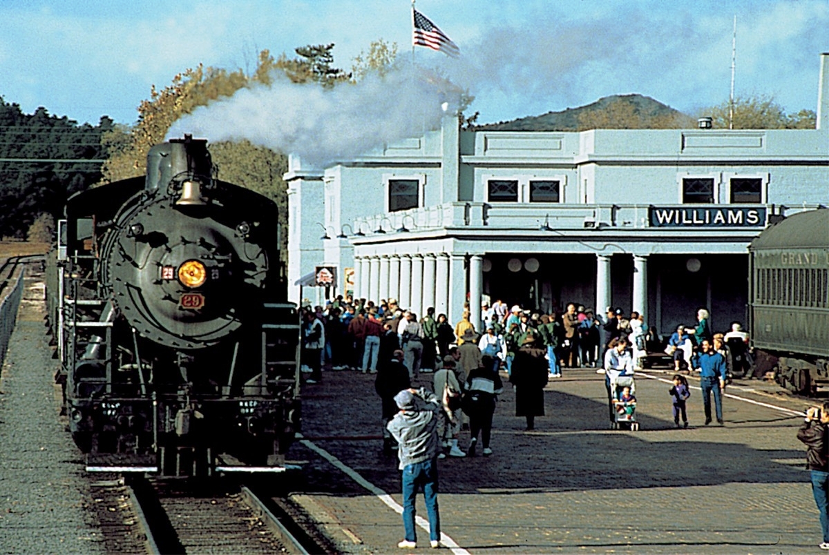
Williams
Photo: Wikimedia Commons · Public domain

Williams

1 hr

The 'Gateway to the Grand Canyon': a Route 66 main street and the depot for the Grand Canyon Railway.

Meteor Crater
Photo: National Map Seamless Server · Public domain

Meteor Crater

1–2 hrs

A nearly mile-wide impact crater just off I-40, with a good museum and rim viewing decks. Admission is privately ticketed.

Standin' on the Corner Park, Winslow
Photo: Tpaairman · CC BY-SA 3.0

Standin' on the Corner Park, Winslow

30 min

Route 66 nostalgia on a Winslow street corner. The restored La Posada Hotel nearby is worth a look for lunch.

Petrified Forest National Park
Photo: Jeffhollett · CC BY-SA 4.0

Petrified Forest National Park

2–3 hrs

A 28-mile park road links I-40 and US-180, past rainbow-colored petrified logs and the Painted Desert.

Montezuma Castle National Monument
Photo: Beyond My Ken · CC BY-SA 4.0

Montezuma Castle National Monument

45 min

A five-story cliff dwelling set high in a limestone wall, viewed from a short, flat loop trail just off I-17.

Jerome
Photo: Seasider53 · CC BY 4.0

Jerome

1–2 hrs

A former copper boomtown clinging to Cleopatra Hill, now full of galleries and tasting rooms, with sweeping views of the Verde Valley.

Tonto Natural Bridge State Park
Photo: ksblack99 · Public domain

Tonto Natural Bridge State Park

1–2 hrs

Possibly the world's largest natural travertine bridge, near Payson. Short but steep trails lead underneath it.

Desert View Watchtower
Photo: Grand Canyon National Park · Public domain

Desert View Watchtower

45 min

Mary Colter's 1932 stone tower at the east end of the South Rim, and the first viewpoint if you enter from Cameron.

Cameron Trading Post

45 min

A historic trading post above the Little Colorado River, known for Navajo tacos and a large Native arts gallery.

Horseshoe Bend
Photo: Thomas Wolf, www.foto-tw.de · CC BY-SA 3.0

Horseshoe Bend

1 hr

The famous 1,000-foot overlook of a Colorado River meander, reached by an easy 1.5-mile round-trip walk. Paid parking.

Antelope Canyon
Photo: Lucas Löffler · Public domain

Antelope Canyon

1.5–2 hrs

Sculpted slot canyons on Navajo land, visited only with a licensed tour. Upper is for light beams, Lower for ladders and curves.

Glen Canyon Dam & Lake Powell
Photo: Adbar · CC BY-SA 3.0

Glen Canyon Dam & Lake Powell

1 hr

The Carl Hayden Visitor Center overlooks the dam and the start of Lake Powell's 1,900 miles of shoreline.

Navajo Bridge, Marble Canyon

30 min

Walk the historic 1929 bridge 470 feet above the Colorado River and look for California condors roosting underneath.

Saguaro National Park (West)
Photo: Saguaro Pictures · CC BY 3.0

Saguaro National Park (West)

1–3 hrs

Dense forests of giant saguaro cactus along the Bajada Loop Drive, with spectacular sunsets from Gates Pass.

Picacho Peak State Park
Photo: ksblack99 · Public domain

Picacho Peak State Park

1–3 hrs

A distinctive volcanic peak beside I-10. Spring wildflowers carpet the base, and the summit trail uses steel cables.

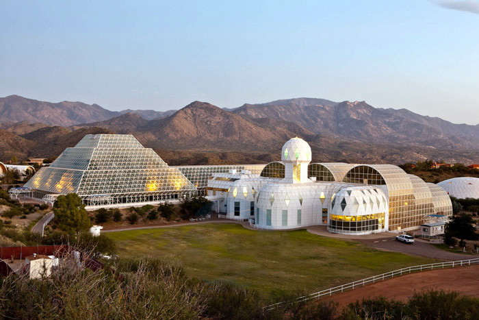
Biosphere 2
Photo: Johndedios · CC BY 3.0

Biosphere 2

2 hrs

The giant glass research facility from the 1990s closed-system experiments, now run by the University of Arizona with guided tours.

Tombstone
Photo: Gillfoto · CC BY-SA 4.0

Tombstone

2 hrs

'The Town Too Tough to Die', with daily O.K. Corral gunfight reenactments and Boothill Graveyard.

Four Corners Monument
Photo: Christian David · CC BY-SA 4.0

Four Corners Monument

30 min

Stand in Arizona, Utah, Colorado and New Mexico at once at this Navajo Nation tribal park. Cash entry fee; Navajo vendors sell fry bread.

Canyon de Chelly National Monument
Photo: Edward S. Curtis · Public domain

Canyon de Chelly National Monument

2–3 hrs

Rim drives overlook Spider Rock and cliff dwellings in a canyon still farmed by Navajo families. The canyon floor requires a Navajo guide.