
Route map
Start / endStopsOvernight
LA to the Grand Canyon: the drive
The drive from Los Angeles to Grand Canyon National Park (South Rim) covers 491 miles (790 km) and takes about 7 hr 30 min without stops, mostly on I-40, I-15 and AZ-64.
That's a lot of time behind the wheel for one day, so we suggest splitting it into 2 days with an overnight in Needles, CA. That keeps each day to about 3 hr 45 min of driving.
We found 10 worthwhile stops within about 25 miles of the route, including Calico Ghost Town, Peggy Sue's 50's Diner, Kelso Depot (Mojave National Preserve) and London Bridge, Lake Havasu City.
| Main roads | Approx. miles |
|---|---|
| I-40 | 319 |
| I-15 | 72 |
| AZ-64 | 52 |
Best time to go: Year-round for the South Rim. The North Rim is a separate trip and normally closes mid-October to mid-May.
Suggested 2-day itinerary
- Day 1: Los Angeles → Needles, CA (245 mi). Stops: Calico Ghost Town, Peggy Sue's 50's Diner and Kelso Depot (Mojave National Preserve).
- Day 2: Needles, CA → Grand Canyon National Park (South Rim) (246 mi). Stops: London Bridge, Lake Havasu City, Oatman and Kingman Route 66 Museum.
Best stops between LA and the Grand Canyon
- 1
Calico Ghost Town
A restored 1880s silver mining town above Barstow, with a mine tour, small museum and old-west storefronts.

Photo: Alexander Mason · CC BY 4.0 - 2
Peggy Sue's 50's Diner
A kitschy 1950s diner in Yermo, right off I-15, and the classic meal stop on the LA–Vegas drive.
- 3
Kelso Depot (Mojave National Preserve)
A 1924 Spanish Mission–style railroad depot turned visitor center, near the 600-foot Kelso Dunes. A quieter alternative to the I-15 grind.

Photo: w:User:Pretzelpaws · CC BY-SA 3.0 - ☾
Overnight in Needles, CA
End of day 1: about 3 hr 45 min and 245 miles from LA.
See hotels in Needles → - 4
London Bridge, Lake Havasu City
The 1830s London Bridge, shipped stone by stone to the Arizona desert in the 1960s and rebuilt over a channel of Lake Havasu.

Photo: Guninvalid · CC0 - 5
Oatman
A Route 66 mining town where wild burros wander the main street. The drive over Sitgreaves Pass is narrow and twisty.

Photo: Pretzelpaws [1] · CC BY-SA 3.0 - 6
Kingman Route 66 Museum
In Kingman's historic powerhouse, covering the Mother Road from wagon trails to the Dust Bowl.
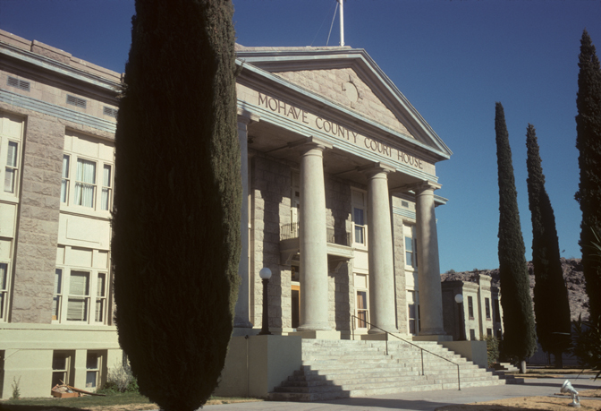
Photo: Calvin Beale · Public domain - 7
Hackberry General Store
A classic Route 66 roadside stop crammed with old gas pumps, signs and a vintage Corvette.

Photo: Marine 69-71 · CC BY-SA 4.0 - 8
Seligman
The town credited with reviving Route 66, full of quirky diners and souvenir shops.

Photo: Vidor at en.wikipedia · Public domain - 9
Williams
The 'Gateway to the Grand Canyon': a Route 66 main street and the depot for the Grand Canyon Railway.
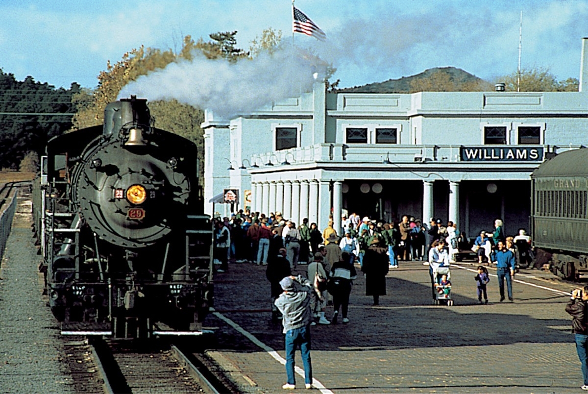
Photo: Wikimedia Commons · Public domain
Near the Grand Canyon
- 10
Desert View Watchtower
Mary Colter's 1932 stone tower at the east end of the South Rim, and the first viewpoint if you enter from Cameron.

Photo: Grand Canyon National Park · Public domain
Where to stay overnight on the way
Hotels and rentals around Needles, CA, the natural end of day one:
Map not loading? See places to stay near Needles →
Where to stay in Tusayan
The South Rim is open all year and has the classic viewpoints: Mather Point, Yavapai and the Desert View Watchtower. Tusayan is the closest town with lodging. Rooms near national parks sell out in peak season, so book early.
Map not loading? See places to stay near Tusayan →
Renting a car for this trip
Most travelers fly into Los Angeles International Airport (LAX) and pick up a car there. Booking a round trip from the same airport is usually much cheaper than a one-way rental. A mid-size car is fine for all paved roads on this route. You only need an SUV for the optional dirt-road detours.
Need a car?
Rental cars at LAX
Compare prices from major and local agencies at Los Angeles International Airport in one search.
Compare rental cars →Free cancellation on most bookings.
Trip cost calculator
Estimate gas or charging, hotels and car rental for a round trip from LA to the Grand Canyon:
LA to the Grand Canyon road trip FAQ
How long is the drive from Los Angeles to Grand Canyon National Park (South Rim)?
About 7 hr 30 min without stops for 491 miles via I-40, I-15 and AZ-64. With breaks for fuel and food, allow around 9 hr 30 min.
What is the halfway point between LA and the Grand Canyon?
Needles, CA is about halfway, roughly 246 miles from each end. It's a good place for fuel and a meal.
Where should I stop overnight between LA and the Grand Canyon?
To keep each day under about 4 hours of driving, stay overnight in Needles, CA. Book ahead in summer and on holiday weekends.
What are the best stops between LA and the Grand Canyon?
Top stops include Calico Ghost Town, Peggy Sue's 50's Diner, Kelso Depot (Mojave National Preserve) and London Bridge, Lake Havasu City. See the full list with detour times above.
How much does gas cost from LA to the Grand Canyon?
About $63 one way in a car that gets 28 mpg with gas at $3.60 a gallon. Use the calculator on this page to plug in your own car and prices.
When is the best time to visit the Grand Canyon?
Year-round for the South Rim. The North Rim is a separate trip and normally closes mid-October to mid-May.
Route calculated from OpenStreetMap data and checked 2026-11-09. Drive times assume normal traffic and no stops.

