
Route map
Start / endStopsHalfway
Denver to Moab: the drive
The drive from Denver to Moab covers 354 miles (570 km) and takes about 5 hr 30 min without stops, mostly on I-70 and US-191.
It's doable in one day, but with fuel, food and a couple of stops plan on roughly 7 hrs door to door.
We found 10 worthwhile stops within about 25 miles of the route, including Boulder, Georgetown, Breckenridge and Vail.
| Main roads | Approx. miles |
|---|---|
| I-70 | 311 |
| US-191 | 31 |
Best time to go: March to May and September to October.
Best stops between Denver and Moab
Before you leave Denver
- 2
Red Rocks Park & Amphitheatre
A natural concert venue between 300-foot sandstone monoliths, open to walk through on non-show days. 30 minutes from downtown Denver.
- 1
Boulder
Pearl Street Mall and the Flatirons from Chautauqua Park make an easy detour on the way to Rocky Mountain National Park.

Photo: Taken by Jesse Varner. Modified by AzaToth. · CC BY-SA 2.5 - 3
Georgetown
A Victorian silver mining town right off I-70, with the Georgetown Loop Railroad and bighorn sheep viewing.

Photo: Nyttend · Public domain - 4
Breckenridge
A historic gold-mining main street at 9,600 feet, with ski runs in winter and alpine hikes in summer.

Photo: Av9 · CC BY-SA 3.0 - 5
Vail
A Bavarian-style pedestrian village. Summer gondola rides go to wildflower meadows.

Photo: G0phy · CC0 - 6
Glenwood Springs
Soak in the world's largest hot springs pool after driving the dramatic I-70 corridor through Glenwood Canyon.

Photo: Nils Huenerfuerst · CC BY 4.0 - 7
Colorado National Monument
Rim Rock Drive winds 23 miles past sheer red canyons and monoliths above Grand Junction. An underrated I-70 detour.

Photo: Daniel Schwen · CC BY-SA 4.0
Near Moab
- 8
Canyonlands: Island in the Sky
A mesa-top district with Mesa Arch at sunrise and Grand View Point looking 1,000 feet down to the White Rim.

Photo: au_ears · CC BY-SA 2.0 - 9
Dead Horse Point State Park
A gooseneck of the Colorado River 2,000 feet below, and arguably the best sunset point near Moab.
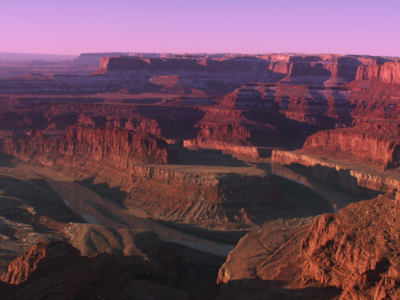
Photo: Mike Nielsen · CC BY-SA 2.0 - 10
Arches National Park
Over 2,000 natural stone arches, including Delicate Arch at the end of a 3-mile round-trip hike.

Photo: Palacemusic · CC BY-SA 3.0
Where to stay in Moab
Base camp for Arches, Canyonlands and Dead Horse Point, plus world-class mountain biking and 4x4 trails.
Map not loading? See places to stay near Moab →
Renting a car for this trip
Most travelers fly into Denver International Airport (DEN) and pick up a car there. If you're not driving back, compare one-way rentals that drop off at GJT. One-way fees vary a lot between companies. A mid-size car is fine for all paved roads on this route. You only need an SUV for the optional dirt-road detours.
Need a car?
Rental cars at DEN
Compare prices from major and local agencies at Denver International Airport in one search. Dropping off near Moab? Search a one-way rental; drop fees vary a lot between companies, so compare first.
Compare rental cars →Free cancellation on most bookings.
Trip cost calculator
Estimate gas or charging, hotels and car rental for a round trip from Denver to Moab:
Denver to Moab road trip FAQ
How long is the drive from Denver to Moab?
About 5 hr 30 min without stops for 354 miles via I-70 and US-191. With breaks for fuel and food, allow around 7 hrs.
What is the halfway point between Denver and Moab?
Silt, CO is about halfway, roughly 177 miles from each end. It's a good place for fuel and a meal.
Can you drive from Denver to Moab in one day?
Yes. At 5 hr 30 min of driving it's a comfortable one-day trip. Leave early so you arrive with daylight to spare.
What are the best stops between Denver and Moab?
Top stops include Boulder, Georgetown, Breckenridge and Vail. See the full list with detour times above.
How much does gas cost from Denver to Moab?
About $46 one way in a car that gets 28 mpg with gas at $3.60 a gallon. Use the calculator on this page to plug in your own car and prices.
When is the best time to visit Moab?
March to May and September to October.
Route calculated from OpenStreetMap data and checked 2026-11-09. Drive times assume normal traffic and no stops.
